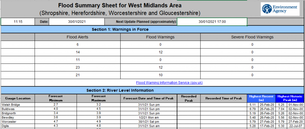
Flood Update 30/01/2021 11.24am
A slow moving front has led to further rainfall overnight (5 to 20mm). This has led to the issuing of a number of additional flood alerts and warnings, particularly in Herefordshire and Gloucestershire.
Through Saturday, the front is forecast to slowly ease and sink south. During the day the rain may turn to snow on the front’s northern edge, especially over Wales. Further warnings /alerts may need to be issued or reissued.
Further frontal rain is now forecast to cross the country through Tuesday and Wednesday, although details are uncertain.
The forecast peaks and timings provided in the above table include today’s rainfall. Due to rain already in the system and rain forecast in the coming days there will be multiple peaks down the catchment. Forecast peaks and timings are also likely to change.
Today’s Flood Guidance Statement is yellow for Worcestershire and Gloucestershire for the next five days with a medium likelihood of ongoing minor river flooding impacts.