Flood Update 29/01/2021 9.45am
A further 5 to 10mm of rain fell overnight, which combined with overnight rain Wednesday into Thursday (15 to 25mm) has caused river levels to raise. There is large uncertainty with regard the weather forecast, however the current forecast is for possible showery outbreaks of rain across the Area today (Friday) but with low rainfall totals. A front is then forecast to move into the Area on Friday evening, with totals likely to be higher on the high ground in the South of the area (15 to 30mm). This may also turn to snow on the northern edge of the front. Sunday afternoon could bring yet more snow/rain and further wintery showers are possible on Monday. A further front could bring more rain or snow through Tuesday.
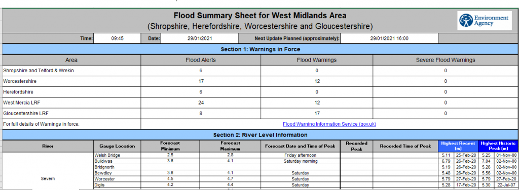
Given the uncertainty in the weather forecast the river level peaks provided in the attached document are only based on the rain that has already fallen and therefore the forecast peaks and timings are likely to change, particularly in Worcestershire and Gloucestershire.
Yesterday’s Flood Guidance Statement was yellow for Worcestershire and Gloucestershire through to Sunday with a medium likelihood of minor river and surface water flooding impacts. Today’s Flood Guidance Statement is likely to extend the minor river flooding impacts for the next 5 days.
Follow the link below for Bewdley’s river level updates
https://riverlevels.uk/river-severn-bewdley#.YBPcWej7TIU