Flood Summary Sheet for Shropshire, Herefordshire, Worcestershire and Gloucestershire 12/02/24
The Flood Guidance Statement is currently yellow for Worcestershire and Gloucestershire for the next 3 days reflecting the likelihood of minor impacts from the River Severn and high tides.
Summary
Isolated showers today (Monday) before frontal rain arrives on Tuesday morning from the southwest bringing modest rainfall amounts. This could result in rivers reaching flood alert levels on the upper Severn in particular. On Thursday, there is still quite a lot of uncertainty in the forecast particularly around how quickly the front will pass through. Current rainfall totals have improved since yesterday, but there is still potential for renewed rises on the Severn similar to levels seen over the weekend, with flood warnings and low-level operational activity possible again from Friday. Elsewhere could see widespread flood alerts and isolated flood warnings. However, due to the very low confidence the forecast for Thursday and Friday remains changeable.
Weather
- Today (Monday) there is a continuation of showers across the patch with catchment averages of generally 1mm to 5mm and isolated maximums of perhaps 10mm in northern and western areas.
- On Tuesday into Wednesday, a frontal system will bring shower outbreaks of rain with isolated totals of 10mm to 30mm over the upper Severn, Wye & Teme and 5mm to 15mm elsewhere.
- Latest rainfall totals for Thursday into Friday are 10mm to 25mm across the area. This is still very low confidence as a lot depends on the speed that the front crosses the area.
- Into the weekend the current signal is for unsettled conditions to remain in place.
Operational activity
- Frankwell being removed this morning, Mon 12/02
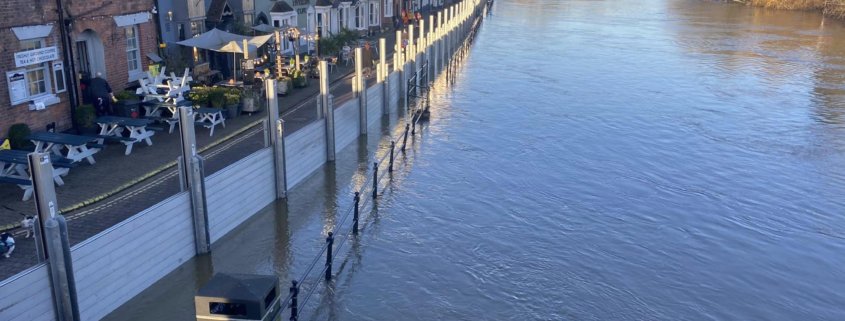
- Bewdley Severn Side North phase 1 deployed
- Upton on Severn (Saxons) New Street, Waterside, and Dunns Lane Gates are closed.
- Mobile pumps have been deployed at Powick, Upton, and Alney Island to ensure surface water behind defences is managed.
- Kempsey pumping station is pumping, but due to increased debris levels the penstock has been closed.
- For the remaining barrier sites, we are closely monitoring the situation and we will update you if the situation changes.
Fluvial summary
- The Severn has peaked upstream of Haw Bridge. Levels elsewhere continue to fall, however frontal rainfall on Tuesday and Wednesday could cause renewed rises with flood alerts possible mainly on the upper Severn.There is a signal for some widespread heavy rainfall on Thursday into Friday. There is a lot of uncertainty regarding this rainfall, however, the latest forecast is suggesting renewed flood alerts and flood warnings from Friday and over next weekend and potentially renewed operational levels on the River Severn.
Tides
- Tidal levels on the Severn and Wye estuaries continue to slowly increase with levels peaking today. After Wednesday Astronomic tidal levels will slowly start to drop and move towards Neap tides in the Severn and Wye Estuaries.
- Tidal and fluvial interaction at Gloucester and Sandhurst remains the key area of focus with the Severn Estuary alert in force and several associated tidal warnings in place. Levels are expected to start to slowly drop at Sandhurst and Gloucester on Tuesday evening’s tides. Water levels at Gloucester and Sandhurst are expected to be highest on this morning’s tide, where we could see 3.9 to 4.3 metres at Gloucester and 4.4 to 4.6 metres at Sandhurst.
- Levels at Sandhurst and Gloucester are not expected to get near to those experienced during Storm Henk (4.7 metres at Gloucester).
- The Wye Estuary flood alert is currently in force and likely to be required until Wednesday morning’s tide. The Wye Estuary warnings at Chepstow and Brockweir have been reached on this morning’s tide and may be required for Tuesday morning’s tide.


